Almost every property data provider in the UK builds on the same set of public registers. HM Land Registry records what sold and who holds title. The Valuation Office Agency sets council tax bands. The EPC register holds energy certificates. Ordnance Survey and Royal Mail supply the address spine that lets the rest be joined together.
What separates one provider from another is rarely the raw source. It is how well the sources are matched to the same property, how fresh each one is, and whether the licence lets you use the result the way you intend.
This reference sets out each register: what it holds, how often it updates, its licence as stated by the publisher, and the key you use to join it. Everything below was checked on the publisher's site on 26 October 2026. Which source answers which question?
Which sources cover sales, land and title?
HM Land Registry (HMLR) publishes four datasets most providers rely on.
- Price Paid Data. Property sales in England and Wales lodged with HMLR for registration, from January 1995. Fields include price, date of transfer, postcode, property type, new build flag, tenure and the address in parts (PAON, SAON, street, town). It is released monthly, and HMLR notes registration typically lags the sale by two weeks to two months, so the latest two months are incomplete. Licence: Open Government Licence v3.0. Sales not for value, such as gifts and court orders, are excluded.
- Title register. The register for an individual title, keyed by title number, is bought per title through GOV.UK. A copy costs £7 per register or title plan.
- UK companies that own property (CCOD) and overseas companies that own property (OCOD). Registered land in England and Wales held by UK companies or corporate bodies, and by overseas entities. Updated on the second working day of each month with the previous month's data, as a full file and a change-only file. HMLR lists both as "Data available free under licence"; you sign up and accept HMLR's data licence before downloading. Fields include title number, tenure and, for CCOD, company registration number.
- INSPIRE Index Polygons. The indicative position and extent of freehold registered titles in England and Wales, one polygon per INSPIRE ID, split by local authority. Updated on the first Sunday of each month. Free under the Open Government Licence, with HMLR and Ordnance Survey attribution statements required. Leasehold titles are not included.
Price Paid Data carries no UPRN on HMLR's published field list, so providers match it to addresses themselves.
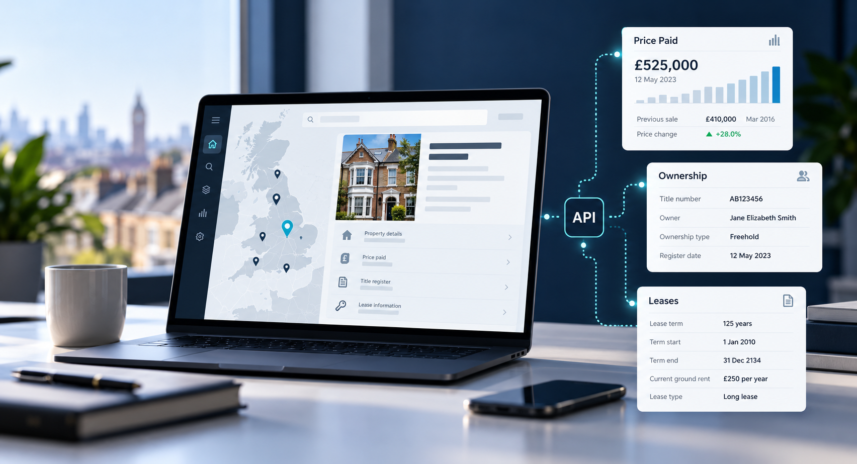
Through the propalt.ai API, a property record looked up by UPRN or UDPRN returns that matched sale history alongside tenure and title numbers, so you can see which HMLR records sit behind it. For the routes to the registered owner itself, see How to Find Out Who Owns a Property in the UK.
Which sources cover the property itself?
- Council tax bands (VOA). The Valuation Office Agency assesses homes in England and Wales into council tax bands: eight bands (A to H) in England based on values at 1 April 1991, and nine (A to I) in Wales based on values at 1 April 2003. You look up a band by address or postcode on GOV.UK. Scotland's bands sit with the Scottish Assessors.
- EPC register (MHCLG). Energy Performance Certificates for domestic and non-domestic buildings and Display Energy Certificates for public buildings in England and Wales, registered since 2008. The data service states content is under the Open Government Licence v3.0 "except where otherwise stated", and the data.gov.uk record notes the data "contains Royal Mail intellectual property". Ordnance Survey confirmed in December 2021 that UPRNs had been added to EPC data. Scottish certificates are held separately.
Which sources form the address spine?
These are the keys everything else hangs on.
- Ordnance Survey AddressBase. AddressBase Premium covers about 40 million addresses and 100 million cross-references across Great Britain, combining local authority, OS and Royal Mail addresses, each referenced by a UPRN. It is updated every six weeks and is a licensed product. OS Open UPRN gives coordinates for each UPRN, also every six weeks, and OS states its OpenData products are released under the Open Government Licence.
- Royal Mail PAF. The Postcode Address File holds over 32 million UK delivery addresses and 1.8 million postcodes, with around 2,500 to 3,000 updates a day. Each delivery point has a UDPRN, an eight-character reference. PAF is licensed. Royal Mail offers free access to eligible public sector bodies and registered microbusinesses, and to charities with income under £10 million for non-commercial use; most other users pay licence fees.
The difference matters. A UPRN identifies an addressable location, including things without a postal address. A UDPRN identifies a postal delivery point. For more on the first, see What Is a UPRN?.
The registers are public. The joins between them are where data quality is won or lost.
Which sources cover ownership by companies?
Companies House publishes a free monthly snapshot of live companies (compiled to the previous month end and available within five working days), daily accounts data and a PSC (people with significant control) snapshot. GOV.UK content is under the Open Government Licence v3.0 except where stated, and Companies House places no rules on use of register data beyond the law. The join key is the company number, which links directly to the company registration number in HMLR's CCOD file. Our guide Is a Property Owned by a Limited Company? walks through that join.
Which sources cover planning, flood and mining risk?
- planning.data.gov.uk. MHCLG's platform collects planning and housing data from local planning authorities and standardises it across England. Coverage is incomplete; the site says "the data does not yet cover all of England". Each dataset carries its own licence and attribution.
- Environment Agency flood data. The Flood Map for Planning flood zones show land at present-day risk of flooding from rivers and the sea, ignoring defences, for England. Licence: Open Government Licence. Update frequency is "as needed"; the flood zones dataset on data.gov.uk was last updated on 22 October 2026. A new National Flood Risk Assessment, including surface water and climate change projections, went live on 28 January 2025.
- Coal Authority data. Now published by the Mining Remediation Authority, it includes coalfield and development high risk area data, viewable free in its map viewer. The development high risk area dataset is under the Open Government Licence and updated "as needed".
All three join spatially: you place the property's coordinates (from its UPRN) inside the published polygon.
Our guide to coal, mining, flood and ground risk checks explains how to read each result, and the planning data API article covers planning.data.gov.uk in more depth.
Which sources describe the area?
- ONS and the UK House Price Index. The UK HPI is produced jointly by HMLR, ONS, Registers of Scotland and Land and Property Services Northern Ireland, published monthly (Northern Ireland quarterly) under the Open Government Licence, with the previous 12 months revised as more sales register. It runs at national, regional and local authority level.
- Census. ONS runs the census for England and Wales every ten years; the latest is Census 2021. ONS content is under the Open Government Licence v3.0. Results join on ONS statistical geographies such as Lower Layer Super Output Areas (LSOAs). Results are released down to output area (OA) level, the building block of LSOAs.
- Ofcom Connected Nations. Ofcom's report on broadband and mobile coverage across the UK, published as an annual report with interim updates. Fixed broadband data downloads come by postcode, output area and local authority under the Open Government Licence; the Spring 2026 release is a January 2026 snapshot.
- police.uk crime data. Street-level crime and anti-social behaviour for England, Wales and Northern Ireland, updated monthly under the Open Government Licence v3.0. Locations are moved to the nearest anonymous "snap point", and each record carries an LSOA code, so it joins at area level, never to a single home.
- DfE Get Information about Schools. The register of schools and other establishments in England, with downloads updated daily under the Open Government Licence v3.0. Each establishment is identified by its URN (Unique Reference Number). Schools join to properties by distance from coordinates.
What does the full set of UK property data sources look like?
| Source | Holds | Updates | Licence (as stated) | Join key |
|---|---|---|---|---|
| HMLR Price Paid | Residential sales, E&W, from 1995 | Monthly | OGL v3.0 | Address and postcode (no UPRN) |
| HMLR title register | Registered title and owner | Per purchase | Paid per title | Title number |
| HMLR CCOD / OCOD | Company-owned titles, E&W | Monthly | Free under HMLR licence | Title number; company number |
| HMLR INSPIRE | Freehold title polygons, E&W | Monthly | OGL with attribution | INSPIRE ID; geometry |
| VOA council tax | Bands A to H (E), A to I (W) | Not stated | Per-address look-up on GOV.UK | Address |
| EPC register | Certificates, E&W, since 2008 | Not stated | OGL except stated; Royal Mail IP in addresses | UPRN |
| OS AddressBase Premium | ~40m GB addresses | Every six weeks | Licensed | UPRN |
| OS Open UPRN | UPRN coordinates, GB | Every six weeks | OGL | UPRN |
| Royal Mail PAF | 32m+ UK delivery addresses | Daily | Licensed (some free tiers) | UDPRN; postcode |
| Companies House | Live companies, accounts, PSC | Monthly snapshot; accounts daily | OGL (GOV.UK) | Company number |
| planning.data.gov.uk | Standardised LPA data, England | Varies | Per dataset | Geometry; reference |
| EA flood zones | Rivers and sea risk, England | As needed | OGL | Geometry |
| Coal / mining data | High risk areas, coalfields | As needed | OGL | Geometry |
| UK HPI | Price index by area | Monthly | OGL | ONS area codes |
| Census 2021 | Population and households | Every ten years | OGL | ONS geographies |
| Ofcom Connected Nations | Broadband and mobile coverage | Annual report plus interim updates | OGL | Postcode; output area |
| police.uk | Crime and ASB, E&W and NI | Monthly | OGL v3.0 | LSOA |
| DfE GIAS | Schools, England | Daily | OGL v3.0 | URN; location |
How do providers join these sources into one record?
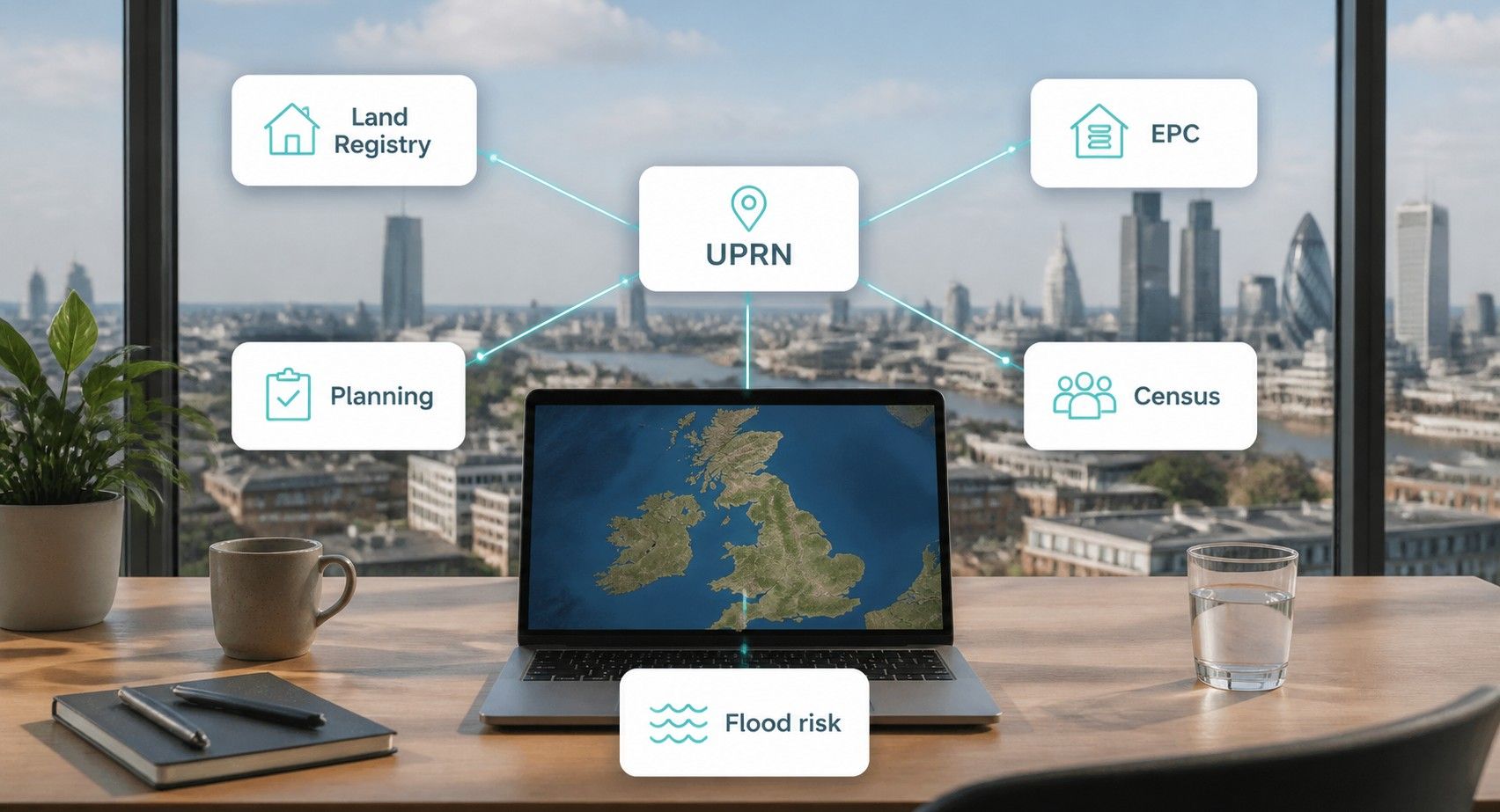
Through the UPRN wherever possible, and through careful address matching where a source has none. The EPC register and OS products carry UPRNs. Price Paid, council tax and older datasets need address matching first. Area sources join by statistical geography, and risk layers join by placing a UPRN's coordinates inside a polygon.
If you would rather query a joined record than build one, our UK property data API buyer's guide compares what providers offer.
When you compare any property data provider in the UK, ask four questions:
- Which registers do you use, and when did each last refresh?
- What share of Price Paid records do you match to a UPRN?
- Which licences sit behind your output, and do they allow your use case?
- What happens in Scotland and Northern Ireland, where HMLR, VOA and EPC England and Wales data do not apply?
For how these sources reach an application, see HMLR Property Data API.
📌 KEY TAKEAWAY
UK property data comes from about a dozen public registers, most of them open under the Open Government Licence, a few licensed (AddressBase, PAF) or free under their own terms (CCOD, OCOD). The UPRN is the join that turns them into one record, and the match rate between sales data and UPRNs is the clearest single test of a provider. Ask every supplier which register sits behind each field and when it was last refreshed. propalt.ai is built on the principle that you should always be able to see that answer.
SOURCES & DATA REFERENCES
- HM Land Registry (checked 26 October 2026). 'About the Price Paid Data.' Contents, fields, monthly release, lag, exclusions, OGL. gov.uk/guidance/about-the-price-paid-data
- HM Land Registry (1 May 2026). 'Public data.' OGL, free-under-licence and chargeable datasets. gov.uk/government/publications/hm-land-registry-data/public-data
- HM Land Registry (checked 26 October 2026). 'UK companies that own property in England and Wales.' Monthly update, licence sign-up, fields. use-land-property-data.service.gov.uk/datasets/ccod
- HM Land Registry (checked 26 October 2026). 'Index polygons spatial data (INSPIRE).' Monthly update, OGL conditions, freehold only. use-land-property-data.service.gov.uk/datasets/inspire
- GOV.UK (checked 26 October 2026). 'Understand how Council Tax bands are assessed.' VOA role, valuation dates, bands. gov.uk/guidance/understand-how-council-tax-bands-are-assessed
- MHCLG (checked 26 October 2026). 'Get energy performance of buildings data.' Certificate types, coverage, OGL statement. get-energy-performance-data.communities.gov.uk
- Ordnance Survey (1 December 2021). 'Open Identifiers Policy enables EPC data release to incorporate UPRNs.' UPRNs in EPC data. ordnancesurvey.co.uk/blog
- Ordnance Survey (checked 26 October 2026). 'AddressBase Premium', 'OS Open UPRN' and 'OS OpenData products.' Coverage, six-weekly updates, OGL for OpenData. ordnancesurvey.co.uk/products
- Royal Mail (checked 26 October 2026). 'Postcode Address File' and 'Glossary.' 32m addresses, daily updates, licensing, UDPRN definition. poweredbypaf.com
- Companies House (checked 26 October 2026). 'Companies House data products.' Free monthly snapshot, accounts, PSC, company number. gov.uk/guidance/companies-house-data-products
- MHCLG (checked 26 October 2026). 'About Planning Data.' LPA data, England coverage incomplete, per-dataset licence. planning.data.gov.uk/about
- Environment Agency (22 October 2026). 'Flood Map for Planning: Flood Zones.' OGL, as-needed updates, England. data.gov.uk
- Environment Agency (28 January 2025). 'Enhancing flood and coastal erosion risk digital services.' New National Flood Risk Assessment. environmentagency.blog.gov.uk
- Mining Remediation Authority / Coal Authority (checked 26 October 2026). 'Free of charge coal mining information' and 'Development high risk area metadata.' OGL, as-needed updates. gov.uk/guidance/using-coal-mining-information
- HM Land Registry and ONS (checked 26 October 2026). 'About the UK House Price Index.' Joint producers, monthly publication, revisions, OGL. gov.uk/government/publications/about-the-uk-house-price-index
- ONS (checked 26 October 2026). 'Census.' Ten-yearly census for England and Wales, OGL. ons.gov.uk/census
- Police.uk (checked 26 October 2026). 'About.' Monthly crime data, snap points, LSOA, OGL. data.police.uk/about
- Department for Education (checked 26 October 2026). 'Get Information about Schools.' Daily downloads, OGL. get-information-schools.service.gov.uk
- Ofcom (Spring 2026, checked 27 October 2026). 'About this data: fixed broadband coverage and full fibre take-up 2026.' January 2026 snapshot; postcode, output area and local authority files; Open Government Licence. ofcom.org.uk/phones-and-broadband/coverage-and-speeds/data-downloads
- HM Land Registry (checked 27 October 2026). 'HM Land Registry: Information Services fees.' Official copy of a register or title plan £7. gov.uk/guidance/hm-land-registry-information-services-fees
Contains HM Land Registry data © Crown copyright and database right 2026. This data is licensed under the Open Government Licence v3.0.